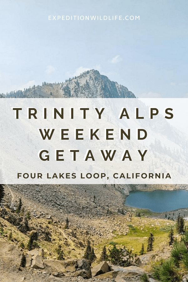
Visiting the Trinity Alps Four Lakes Loop is the perfect mountain getaway in Northern California.
This post contains affiliate links for which Expedition Wildlife may receive a commission (where applicable) at no additional cost to you.
Backpackers and weekend hikers will enjoy delving into the Trinity Alps Wilderness. Alpine lakes and meadows, wildlife, and beautiful mountain peaks await those willing to make the effort!
The hikes in this region aren’t without challenges, but the views and rewarding camping spots make the journey worth it.
The Four Lakes Loop, in particular, is an ideal trek for a long-weekend away.
Did you know Wilderness areas are wonderful stargazing spots? Read more about some of the best places to go stargazing in the US!
We recommend taking two nights and three days to hike this approximately 20-mile trail:
- A day to hike to your campsite along the Four Lakes Loop
- The next day to hike the Loop itself, as well as any side trails or summits you might want to accomplish, and
- A third day for hiking back out
You can cut it down to one night, however, this makes for two long and arduous days. Breaking it up into three days gives you more time to enjoy the scenery around you!
Here’s the what’s what on the Four Lakes Loop, including what to expect, tips, and other trekking information.
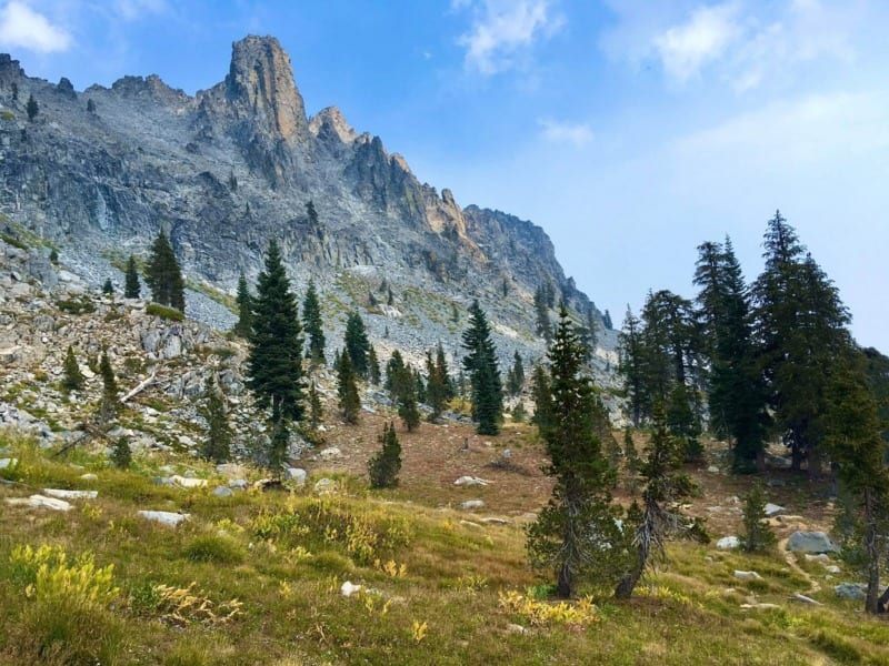
The view from Deer Creek Meadow – just look at those stunning granite peaks! Photo by Christa Rolls
What to do before you go into the Trinity Alps Wilderness
Before embarking on your trip, be sure to do the following things.
- Go online to print out your campfire use permit. Even if you only plan to use your portable stove burner or Jetboil, you must get one of these free permits. You also must have a physical copy with you during your trek.
- Stop by the Ranger Station in Weaverville and get your free wilderness permit. Permits can be obtained from outside the Ranger Station, even when the station is closed.
- The permit costs nothing and is useful for logging use in the wilderness area as well as ensuring your safety if something were to happen to you and search and rescue needed to find you.
- Check the fire and weather reports for the area before your trip. You can call the Ranger Station ahead of time to get their inside knowledge on conditions in the area. This is especially critical during fire season when lightning strikes can cause wildfires in the mountains rather quickly.
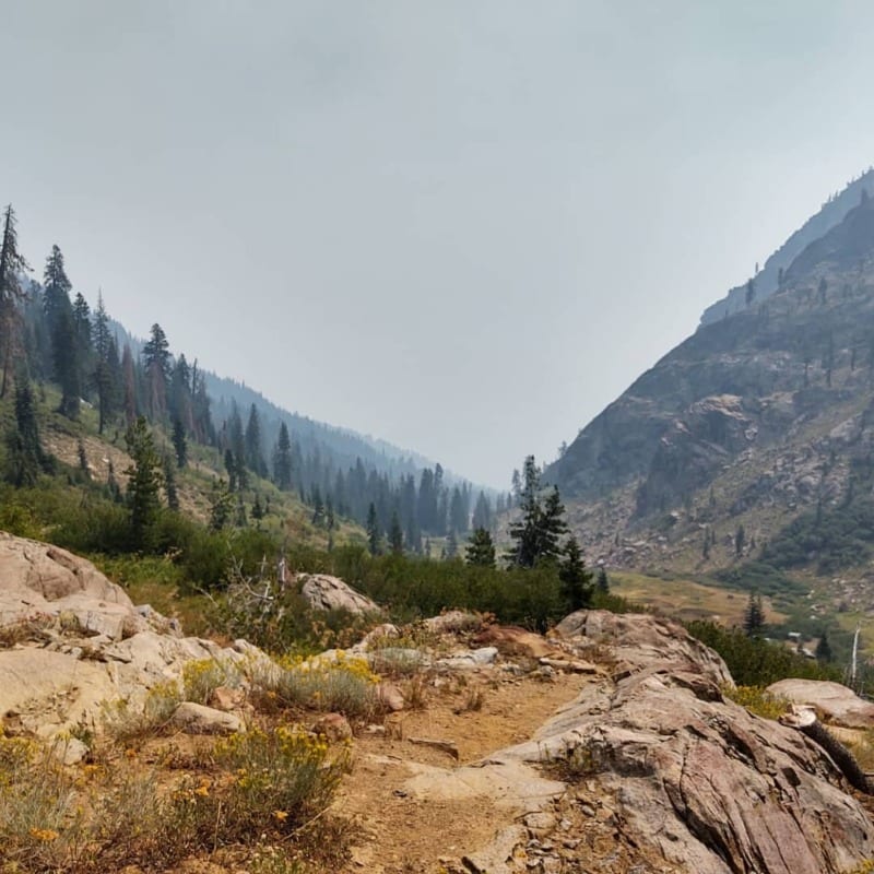
During high fire season, it’s not uncommon for smoke to linger in the canyon along the river. This means lower air quality during your hike. Photo by Christa Rolls
Getting to the Four Lakes Loop
The Four Lakes Loop is located high in the Trinity Alps Wilderness, and there are three out-and-back routes you can take to access it.
Long Canyon: A 13.2-mile out-and-back trail that leads to Deer Lake up through Long Canyon. This route is the shortest, but arguably one of the hardest, as you consistently travel uphill more than 4,000 feet over 5 miles to reach Deer Lake. This is the route we took to get to the top.
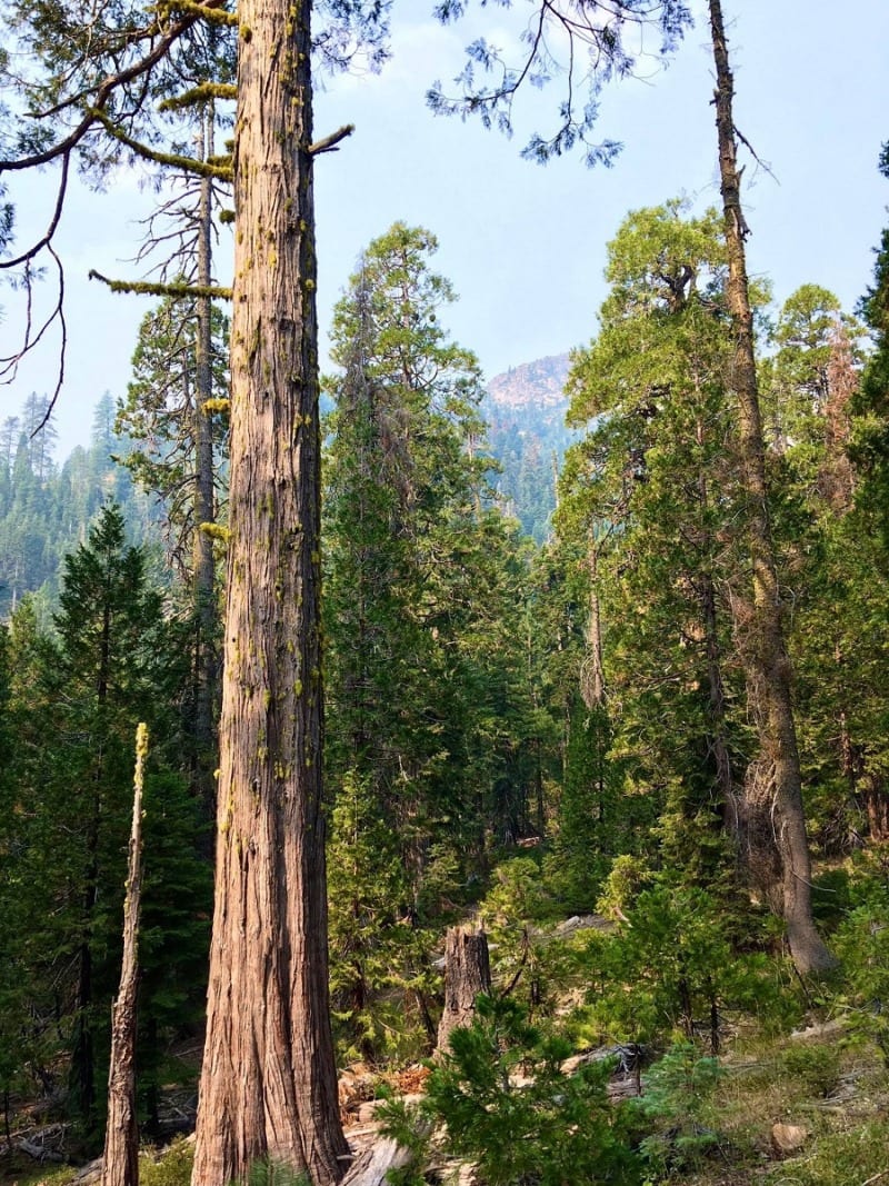
Walk past big, beautiful trees as you climb higher into the Trinity Alps Wilderness. Photo by Christa Rolls
Stony Ridge: A 16.3-mile out-and-back trail that also leads to Deer Lake and past the popular Echo Lake. Stony Ridge is considered another hard route, as approximately 4,000 feet of elevation gain is covered in an 8-mile period. Some hikers have suggested this route is the more varied and scenic.
Swift Creek: An 18.1-mile out-and-back trail that leads you to the northeast side of the Four Lake Loop, closer to Luella Lake. While this route is longer, it is more moderate, with less elevation gain and loss over a longer distance. Small waterfalls and sweet meadows can be enjoyed along the way.
No matter which route you take, plan on some pretty significant elevation gain and loss and a slower pace.
The Long Canyon Route
The Long Canyon Trailhead is about a 30-minute drive from the Weaverville Ranger Station, and is easily accessible off of Highway 3. Signs for “Long Canyon Trailhead” can be easily spotted off of the main road and forest roads that lead to the trailhead.
Notably, the parking lot at Long Canyon is not big, but it is more easily accessible than other routes, including Stony Ridge. There is some washboarded road for about a mile leading to the trailhead, but it’s manageable without a 4×4.
The Long Canyon route is a challenging route up and back.
It starts by climbing through covered forest, to riparian meadows, to subalpine rocky landscape before entering the meadows that lead to the Four Lakes. Take some time to stretch for a moment at the trailhead, as you start climbing pretty steadily from the get-go!
We really enjoy varied terrain during our hikes, and this route certainly provided that.
Keep in mind that the riparian area may be more prone to mosquitos and midges, so bring some bug spray along.
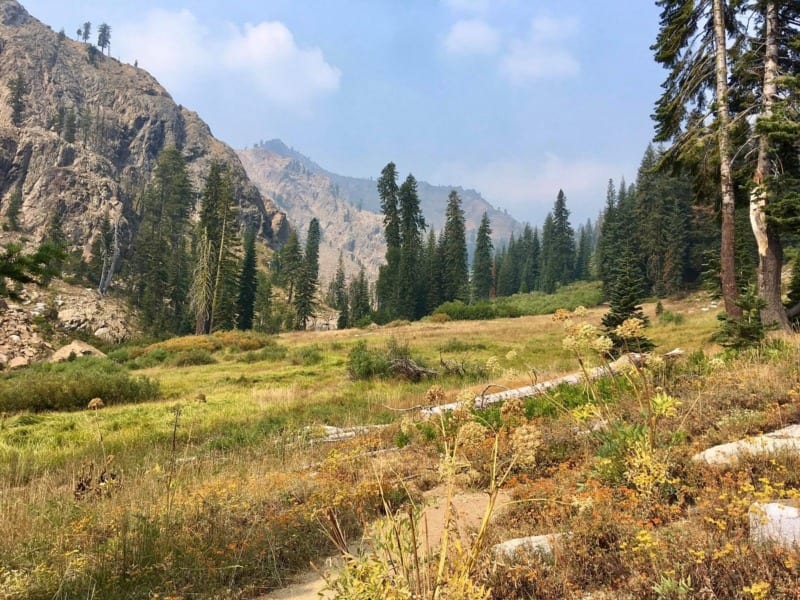
In June and July, these meadows are teeming with all variety of wildflowers in bloom! Photo by Christa Rolls
Also, while hiking in pants doesn’t seem fun during California’s summer, the end of summer yields some pretty tall and overgrown plants on either side of the trail. To avoid getting rubbed by stinging nettle, we recommend wearing pants for the ascent and descent on this route.
If you get to the trailhead later in the evening, there are forest service campsites around Trinity Lake as well as starting about a mile up the Long Canyon Trail. These sites are more for larger groups, but if they are open, you can certainly stay there.
Trekking the Four Lakes Loop
Trinity Alps Four Lakes Loop is a 6-mile loop with fairly significant elevation gain and loss (plus and minus 2,000 feet total).
Along its route, you’ll pass by multiple, stunning alpine lakes, specifically Deer Lake, Summit Lake, Diamond Lake, and Luella Lake. Here, you can relax, swim, or set up camp at any of the designated camping sites.
The most popular direction to hike the loop is clockwise, as you’ll get a good vantage point of the surrounding mountains. Plus, you’ll have longer stretches going downhill than uphill in this direction.
Deer Lake is the more popular site where people camp out, as it’s the first lake you reach from both the Long Canyon and Stony Ridge routes. After a long day of climbing, Deer Lake certainly looks like an oasis! An ample number of campsites can be found here, so there shouldn’t be too much trouble finding a site.
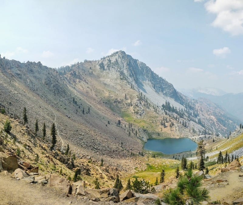
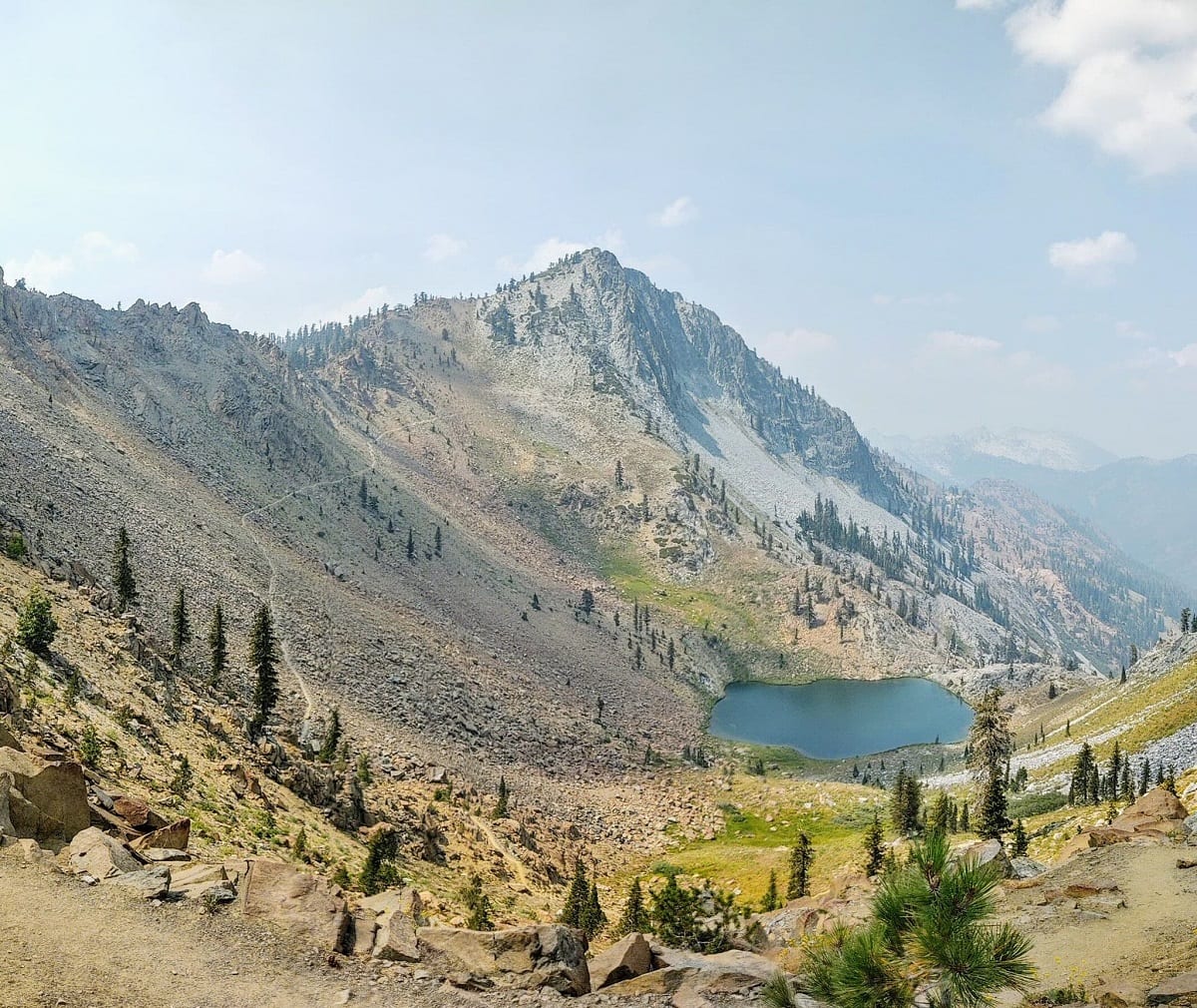
The view of Deer Lake as seen after turning the corner from Deer Creek Meadow. Photo by Christa Rolls
Summit Lake is the only lake where you have a little pathway diversion from the main route. It’s also the most treed and offers some nice, secluded campsites next to the lake.
Diamond Lake, in particular, is known for its stunning sunsets, as its mountain horizon faces west. However, it only has a couple of campsites available, so arrive early to snag one if you have your eye on a sunset spot!
Luella Lake is the smallest of the lakes, but also one of the best for swimming. Since it’s smaller, clearer, and more shallow, it absorbs a good amount of UV during the day, helping to make it a little less frigid!
Tips for getting the most out of your trip
Have a full tank
Make sure to fill up on gas in Weaverville or before leaving I-5 before embarking into the mountain roads of the Trinity Alps.
The elevation gain and loss getting to these trailheads can decrease your miles per gallon pretty significantly.
This is also a great safety tip, as if you need to ever get away from the trailhead for emergency reasons, you don’t want to have to also worry about finding a gas station.
Get good trekking poles
Having a set of sturdy trekking poles to help with the elevation gain and loss along the way will make a world of difference on this hike.
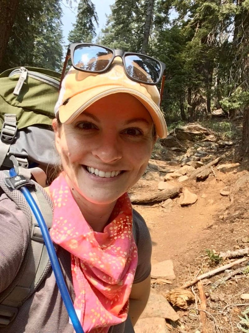
The trail is largely uneven and rocky terrain, and a lot of uphill traveling! Photo by Christa Rolls
Try to start earlier in the day
Get an early start to the trail, especially on weekends. The Long Canyon Trailhead, for example, did not have a lot of parking available and you want to make sure you get a camping spot you’ll be happy with.
Pack enough water for the hike up
Bring plenty of water on your way up to the Lakes.
Even in August, the glacial water was still running through Long Canyon, however, you’ll move away from running water once you get to the scramble at the top.
Fill up your water reserves before you start to ascend to Bee Tree Gap, with Gibson Peak on your right.
Wilderness areas often don’t have many signs
Note that since this route takes you into the wilderness area, you won’t see a ton of signs indicating where you are going! This is typical of wilderness areas.
The trailhead and trail is well-established, so you shouldn’t have issues with finding the trail itself along the way. Subtle notches in the trees will also guide the way.
Before embarking on the trail, get a map of the area at the Ranger Station or print one out ahead of time to understand your route better.
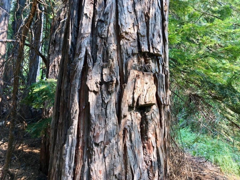
Note the subtle notch in a tree found along the Long Canyon Route in the Trinity Alps Wilderness. Photo by Christa Rolls
Wildlife in the Trinity Alps
Bears, mountain lions, snakes, marmots, birds, deer, and more can be spotted in the Trinity Alps.
For the most part, you don’t need to worry about having interactions with any of these animals.
This being said, always practice good bear safety by hanging your food or using a bear canister, and not leaving any food or trash at camp. These practices lead to “bad bear” behavior and can lead to potentially dangerous and deadly interactions, both for humans and the bear.
There is a healthy population of mountain lions in the Trinity Alps. However, they prefer to keep to themselves. Deer also make up a majority of their diet, and there is a good number of them available for the lions to eat.
In the unlikely scenario that you run into a mountain lion, do not run away. Rather, make yourself look large while creating noise and slowly backing away.
Take some time to enjoy the scenery and wonderful wildlife found in the wilderness that surrounds you.
READ NEXT | How to Watch Wildlife Ethically
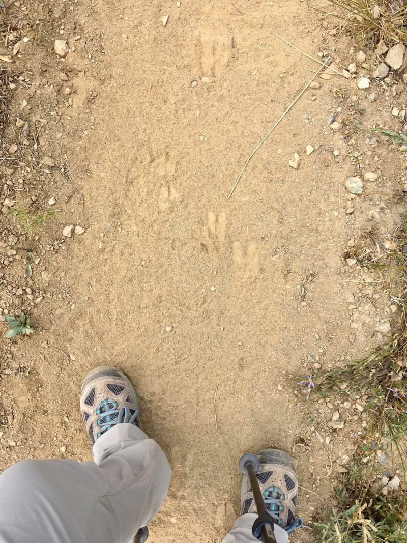
Deer prints along the Four Lakes Loop trail. Photo by Christa Rolls
Hiking Etiquette and Leave No Trace
Whenever you spend time in nature, you should always leave your surroundings better than you found them.
You can read more about the Leave No Trace principles on their website, but here are some things to keep in mind every time you’re outside.
- Always pack out what you pack in. This includes any trash, fruit peels (yes, even apple cores and orange and banana peels), and toilet paper.
- Go to the bathroom no closer than 200 feet from the nearest water body or water source. You don’t want to drink that, and neither does anyone else.
- Don’t wash your dishes in alpine lakes. This should be done away from drinking sources and tent setup locations to deter bears.
- Stay on the designated trail and don’t deviate off-trail. You’ll notice some meandering trail spots, but try not to contribute to these.
- Always follow proper fire safety rules, and don’t set fires unless in designated fire pit areas.
- Never feed wildlife and do your part to keep wildlife wild.
Enjoy spending time outdoors in these beautiful mountains. Let us know if you have any questions or are planning a trip here!
Happy Hiking,
Christa and Nathan

Leave A Comment